Flood Zones 2 and 3 do not stop a scheme by themselves. What stops schemes is the test each zone triggers, and the fact that some combinations of zone and land use are supposed to be refused however good the design is. This post gives you the zone definitions in annual probability, when the sequential and exception tests apply, and where the line is drawn between a hard site and a dead one.
Everything below is from the National Planning Policy Framework published on 17 August 2026. Flood risk policy now sits in chapter 18, as policies F1 to F9, and the flood zone definitions, the vulnerability classification and the compatibility table are in Annex F of the Framework itself. The Framework no longer uses paragraph numbers, so any advice citing an NPPF paragraph for the sequential test is citing a document that has been replaced.
One live inconsistency to be aware of. As of 15 September 2026, the planning practice guidance on flood risk and coastal change was last updated on 17 September 2025 and still refers to “Annex 3” of the Framework for the vulnerability classification. That annex no longer exists. Where the guidance and the Framework disagree, the Framework is the document in force.
What Flood Zones 2 and 3 actually mean
The zones are a probability of flooding from rivers and the sea, ignoring flood defences. That last point catches people out: a site behind a defence is still mapped at the risk it would face without it.
| Zone | Annual probability of flooding |
|---|---|
| Zone 1 – low probability | Less than 0.1% from rivers or the sea. All land outside Zones 2, 3a and 3b. |
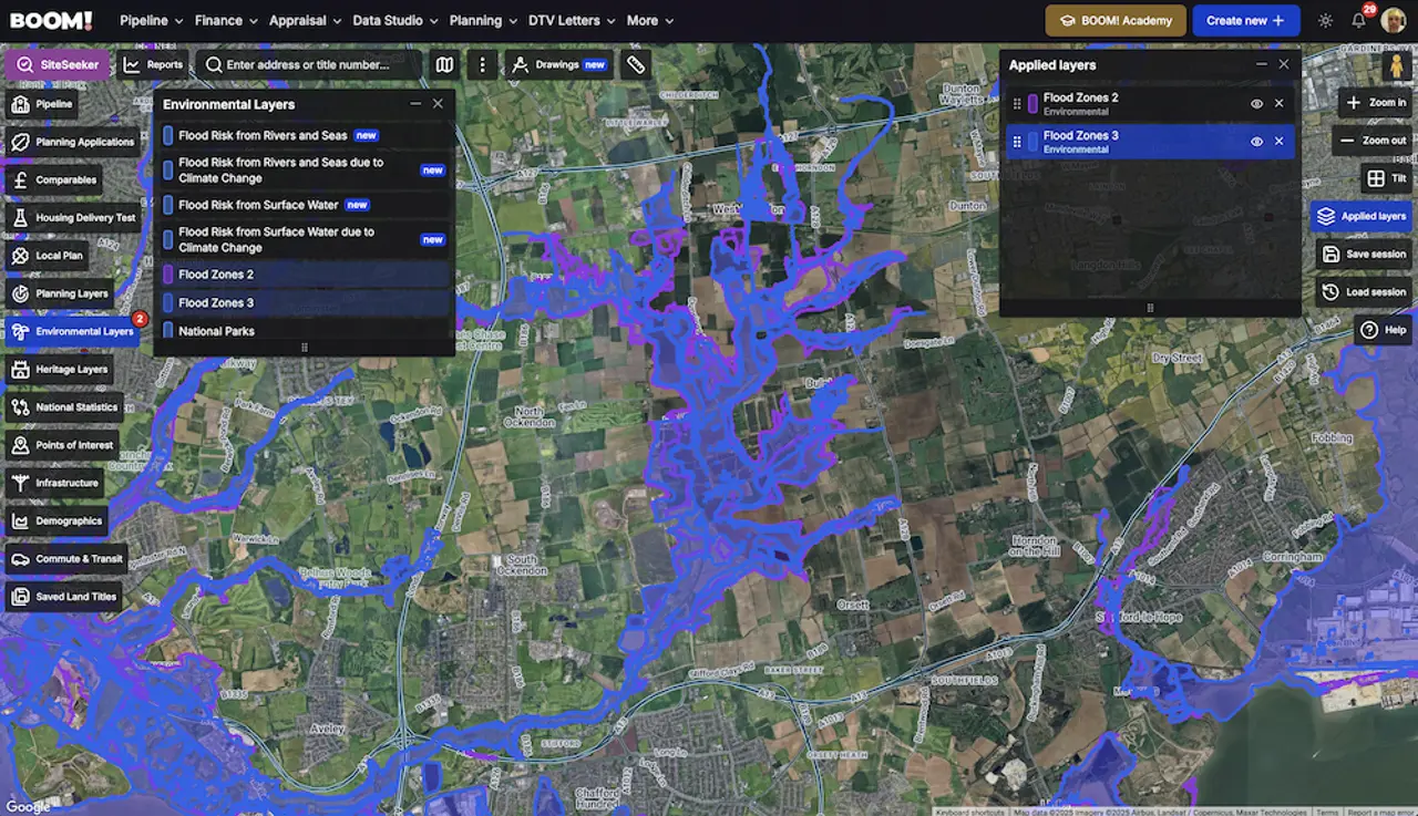
| Zone 2 – medium probability | Between 1% and 0.1% from rivers, or between 0.5% and 0.1% from the sea. Shown light blue on the Flood Map for Planning. |
| Zone 3a – high probability | 1% or greater from rivers, or 0.5% or greater from the sea. Shown dark blue on the Flood Map for Planning. |
| Zone 3b – functional floodplain | Land where water has to flow or be stored in a flood. Normally land with a 3.3% or greater annual probability with existing defences working, or land designed to flood. |
Two practical consequences. First, the sea threshold is stricter than the river one – 0.5% rather than 1% – so coastal sites tip into Zone 3a sooner than an inland developer expects. Second, Zone 3b is not on the national map. The Flood Map for Planning does not separate 3b from 3a. It is the council’s strategic flood risk assessment that identifies functional floodplain, agreed with the Environment Agency. If you have not read the SFRA, you do not know which Zone 3 you are in.
Since 25 March 2025 the zones have been produced from the second National Flood Risk Assessment (NaFRA2), and Zones 2 and 3 no longer overlap – each parcel is attributed to one zone. If you are working from a map you downloaded before then, redownload it.
When the sequential test applies, and when it does not
Policy F5 steers development to the lowest risk land: where the test applies, you should not be in a flood risk area if a reasonably available alternative site suitable for the development exists at lower risk. It bites on risk from any source, not just rivers and the sea.
The 2026 Framework added a limit that matters commercially: the search area should not be greater than the anticipated catchment of the development in terms of its likely occupiers or users. A whole district is no longer the automatic answer.
The test is not required for:
- Sites allocated in the development plan that were sequentially tested when the plan was prepared.
- Sites where a site-specific flood risk assessment shows clearly that no built development, including access and escape routes, would sit on land at risk from any source now or in the future.
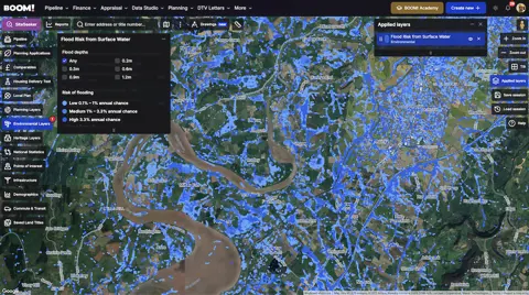
- Sites at risk from surface water only, where layout, design and mitigation keep occupiers safe for the lifetime of the development without increasing flood risk elsewhere.
- Householder development, non-residential extensions with a footprint under 250m², and changes of use – other than changes of use to a caravan, camping, chalet, mobile home or park home site.
That surface-water carve-out is the one most worth knowing. A site whose only problem is pluvial risk can be taken out of the sequential test altogether on the strength of a competent FRA.
The exception test, and the refusals nobody argues out of
Annex F sorts land uses into five vulnerability classes – essential infrastructure, highly vulnerable, more vulnerable, less vulnerable and water compatible – and then tells you which combinations work. Housing is “more vulnerable”. Basement dwellings and permanent caravans and park homes are “highly vulnerable”.
| Category | Zone 1 | Zone 2 | Zone 3a | Zone 3b |
|---|---|---|---|---|
| Essential infrastructure | Appropriate | Appropriate | Exception test | Exception test |
| Highly vulnerable | Appropriate | Exception test | Refuse | Refuse |
| More vulnerable (housing) | Appropriate | Appropriate | Exception test | Refuse |
| Less vulnerable | Appropriate | Appropriate | Appropriate | Refuse |
| Water compatible | Appropriate | Appropriate | Appropriate | Appropriate |
- Appropriatethe exception test is not required
- Exception testpermitted only if the exception test is passed
- Refusethe Framework says development should be refused
Which uses the Framework treats as incompatible with each flood zone, and where the exception test applies. NPPF Annex F, Table 3 (August 2026, p.128). The cells are unchanged from the previous guidance, but an incompatible use is now to be refused rather than 'not permitted'. This grid answers whether a use can go in a zone, not whether you will be asked to prove it - the sequential test runs first and separately under policy F5.
Where a scheme mixes vulnerability classes, the highest one governs unless the development is considered in its component parts. In Zone 3a, essential infrastructure has to be designed to stay operational and safe in a flood; in Zone 3b it also has to cause no net loss of floodplain storage and not impede flows or push risk elsewhere.
The 2026 Framework is blunter than its predecessors here: incompatible development should be refused, in terms. A residential scheme on functional floodplain is not a hard planning argument, it is a refusal.
Where it does apply, the exception test requires all three of: wider sustainability benefits to the community that outweigh the flood risk; safety for the development’s anticipated lifetime; and no increase in flood risk elsewhere, with a reduction overall where possible. It is informed by a site-specific FRA, and it is not needed where the sequential test was not needed, or where the allocation was exception-tested at plan stage.
Where the money goes on a Zone 2 or 3 site
- The FRA itself. Required for every proposal in Zones 2, 3a and 3b, and in Zone 1 for sites of a hectare or more, land with identified critical drainage problems, and land shown as at risk from any source.
- Levels and layout. Raised finished floor levels, habitable space off the ground floor, safe access and egress, compensatory flood storage. Each of those takes units, area or value off the scheme.
- Exit risk. In April 2024 Nationwide stopped lending on a small number of high flood risk homes. Price the possibility that your buyer’s lender says no.
How to work a flood zone site without wasting months
A Zone 2 site with an otherwise strong planning case is often worth buying, because the discount is priced off the label rather than off the actual cost of dealing with it. A Zone 3a residential site is a genuine planning project with an exception test at the end of it. A Zone 3b residential site is not a project.
The order to work in is: identify the zone on the Flood Map for Planning, check the SFRA for functional floodplain and critical drainage areas, check surface water separately, then decide whether you are buying a design problem or a policy problem. Only the first of those is solvable with money.
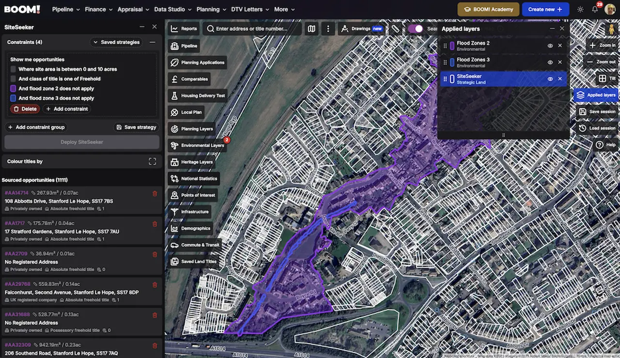
BOOM! carries Flood Zone 2 and Flood Zone 3 as map layers alongside flood risk from rivers and seas and from surface water, so you can see all of it over a title boundary rather than one postcode at a time. There are free postcode checks for Flood Zone 2 and Flood Zone 3 if you just want a quick answer on one site.
Worth reading next: how to screen flood risk across a whole search area, and how settlement boundaries decide the other half of the argument.