Agricultural Land Classification grades farmland from 1 to 5 on how productive it is, and the line that matters to a developer falls inside Grade 3. Grades 1, 2 and 3a are best and most versatile land, which national policy steers development away from. Grade 3b is not.
The trap is that no published map settles which side of that line your field sits on. This guide covers what the grades mean, what national policy actually says about them, and why the only thing that resolves 3a from 3b is a survey on the ground.
The grades, and what each one signals
ALC assesses the inherent capability of land based on climate, site and soil — not on what is currently grown. The system is graded 1 to 5, with Grade 3 subdivided into 3a and 3b since the 1988 MAFF guidelines.
| Grade | Quality | BMV? | What it means for a planning case |
|---|---|---|---|
| 1 | Excellent | Yes | Strongest steer away. Expect the loss to be weighed heavily against the scheme. |
| 2 | Very good | Yes | Same policy treatment as Grade 1 — the framework does not distinguish within BMV. |
| 3a | Good | Yes | The contested boundary. Most greenfield arguments are won or lost here. |
| 3b | Moderate | No | Outside BMV. Agricultural quality stops being a meaningful objection. |
| 4 | Poor | No | Severe limitations. Not a constraint in itself. |
| 5 | Very poor | No | Very severe limitations, normally grass only. Not a constraint in itself. |
Land can also be recorded as non-agricultural or urban. Neither carries agricultural protection, but neither carries any other kind of permission either — an urban classification tells you nothing about conservation areas, listed buildings, flood risk or contamination.
The definition of best and most versatile land is set out in the glossary of the National Planning Policy Framework published on 17 August 2026: “Land in grades 1, 2 and 3a of the Agricultural Land Classification.”
What national policy actually says
Less than most people assume. There is no prohibition on developing BMV land. Policy N2(1)(b) of the 2026 framework asks decision-makers to:
“Take into account the quality of agricultural land (including that classified as best and most versatile agricultural land, and its grade), and if significant development of agricultural land is necessary, use areas of poorer quality land where possible”
That is a steer, not a bar. It bites hardest in two situations: where there is an alternative site of poorer quality that could take the development, and at plan-making stage, where policy N1(1)(c) tells authorities to steer allocations towards land of least environmental value, “avoiding the use of higher quality agricultural land where land of poorer quality is available”.
One thing to stop citing: the written ministerial statement of 15 May 2024 on solar and protecting food security and BMV land. Annex A of the 2026 framework lists it among the statements whose content has been incorporated or superseded, so it no longer stands on its own.
3a versus 3b is the whole argument
Grade 3 covers a large share of English farmland, and the subdivision decides whether it is protected. A site that comes back 3b has effectively removed agricultural quality as an objection. A site that comes back 3a has to run the alternatives argument.
This is why the grading is worth establishing before you commit rather than after. It is also why objectors commission their own ALC survey: the boundary between 3a and 3b turns on wetness class, droughtiness and soil texture, which are matters of judgement within a published methodology, and two competent surveyors can reach different answers on the same field.
The map cannot settle it, and this is where money gets lost
For decades the only national coverage was the Provisional ALC map, surveyed at reconnaissance level at 1:250,000. It did not subdivide Grade 3 consistently, it did not resolve features below about 80 hectares, and Natural England has always said it should not be used to assess an individual field or development site.
Defra has now replaced it with the Predictive Agricultural Land Classification Map for England. That is a real improvement: it is modelled from the national soil data, it follows the current MAFF 1988 methodology, and it does subdivide Grade 3 into 3a and 3b.
It is still not a site-level answer. It is published as a strategic map at a 1:250,000 user scale, modelled on a 50 metre grid taking the most limiting factor per square. That is the right tool for a search across a district and the wrong tool for arguing about a nine-hectare field at committee. Only a field survey — soil pits, auger borings, a qualified surveyor applying the 1988 guidelines — produces a grading that a planning authority will treat as determinative.
Use the map the way it is designed to be used: to rank and filter opportunities, and to tell you when you need to commission a survey. The survey is not a large cost relative to a greenfield land purchase, and on a Grade 3 site it is the cheapest way to find out whether you have a scheme.
What the Land Use Framework changes
Defra published the first Land Use Framework for England on 18 March 2026. Two commitments in it matter to anyone sourcing greenfield land.
- Government will “safeguard our best and most versatile farmland from permanent land use change (such as woodland creation and urban expansion) by publishing updated Agricultural Land Classification data and mapping as it becomes available”.
- It will “complete a technical review of the ALC system by 2028 so that new data and methodologies are incorporated to better classify agricultural land”.
The direction of travel is better data and more of it, which cuts both ways. Sites that the old provisional map showed as undifferentiated Grade 3 will now show as 3a or 3b, and some of them will be worse for you than the ambiguity was. The framework also notes, correctly, that BMV status does not preclude development — it is the landowner’s decision what to propose, and the planning balance decides the rest.
Two assumptions that cost money
- “Low-grade land means easy approval.” ALC is one consideration among many. Grade 4 and 5 land is often poorly drained, in a flood zone, remote from services, or ecologically valuable for exactly the reasons it farms badly. Removing one objection does not create a consent.
- “The map says 3b, so we are fine.” The map is strategic. If the grading is load-bearing for your case, an objector will commission a survey even if you do not.
How to work it into sourcing
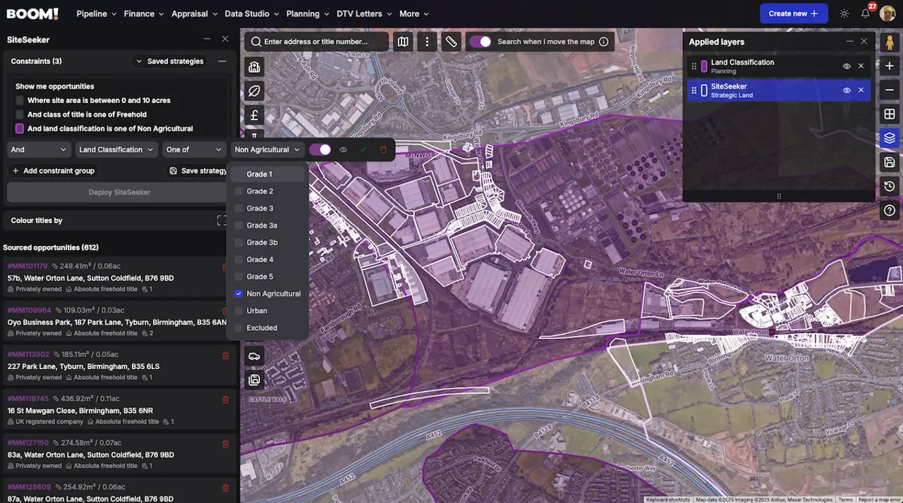
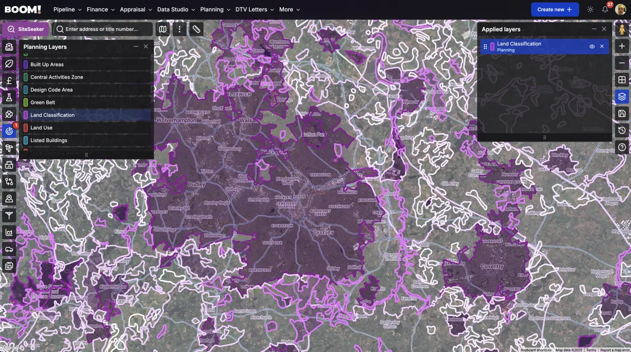
In BOOM!, land classification is a Data Studio layer and a SiteSeeker constraint. The constraint filters on the grades directly — 1, 2, 3a, 3b, 4, 5, non-agricultural and urban for England and Wales, and the Scottish land capability classes where you are searching there — so you can rule BMV land in or out of a search rather than checking sites one at a time.
Treat that as triage, not evidence. It tells you which sites are worth a survey. Alongside it, check the constraints that most often sit on the same greenfield parcel: the Green Belt, which is a separate designation with nothing to do with land quality, and flood risk, which frequently explains why a field is Grade 4 in the first place.